


Quintillion’s System
Space Operations
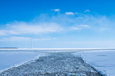
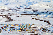
Downloading Satellite Data at US’ Northernmost Point
Presenting the Quintillion HiLDA Ground Station
Quintillion has partnered with ATLAS Space Operations—the leader in ground station technology services—to build North America’s highest latitude satellite ground station in Utqiaġvik, Alaska. This will enable US-based organizations to download satellite data and upload commands directly to and from American soil.
Currently, companies and agencies launching polar-orbiting satellites face a dilemma: wait an extended period of time before downloading and backing up their data, or rely on a ground station in a foreign country. For those with sensitive data, this presents a significant problem—until now.
Quintillion’s ground station at Utqiaġvik will serve as a crucial crossroad between space and terrestrial communications. It represents one landing point on Quintillion’s broader network map, which it is developing as the foundation for American economic and security advancement, stemming from the Arctic.
“Quintillion Represents A Secure Connection Between Ground and Space in the American Arctic“
George Tronsrue III, CEO
With such great American investment in satellite infrastructure and data, we must do all we can to secure it.
There’s a lot of activity in the sky. We increasingly rely on data captured from above to power everyday life on earth, from populating our maps, to monitoring the climate and protecting our national security.
Data collected via satellite is transmitted back to earth via a ground station. With every passing second, satellites collect thousands of data points, making the location and distance between ground stations not a matter of convenience, but of security.
Recent decreases in launch costs have led to the explosion of new satellites entering our planet’s orbit. A satellite designed to gather data is only as valuable as its ability to capture and communicate that data. Therefore, communication systems on the ground are critical for ensuring that information gathered from space can be used on earth. For these organizations, a high latitude ground station serves as an additional, diversified backup point in a remote corner of the country. From a national security perspective, adding a high latitude ground station closes the polar data bottleneck, provides a safe harbor for classified data, and allows for the diversification of data channels.
Northernmost Satellite Ground Station on US Soil
Located in Utqiaġvik at 72 degrees latitude, 320 miles north of the Arctic Circle.
Connected to major internet exchanges in the lower 48 via fiber.
Operates on S and X bands, with Ka band in planning.
Closes critical space security gaps; reduces reliance on foreign owned stations.